WRF
HREF
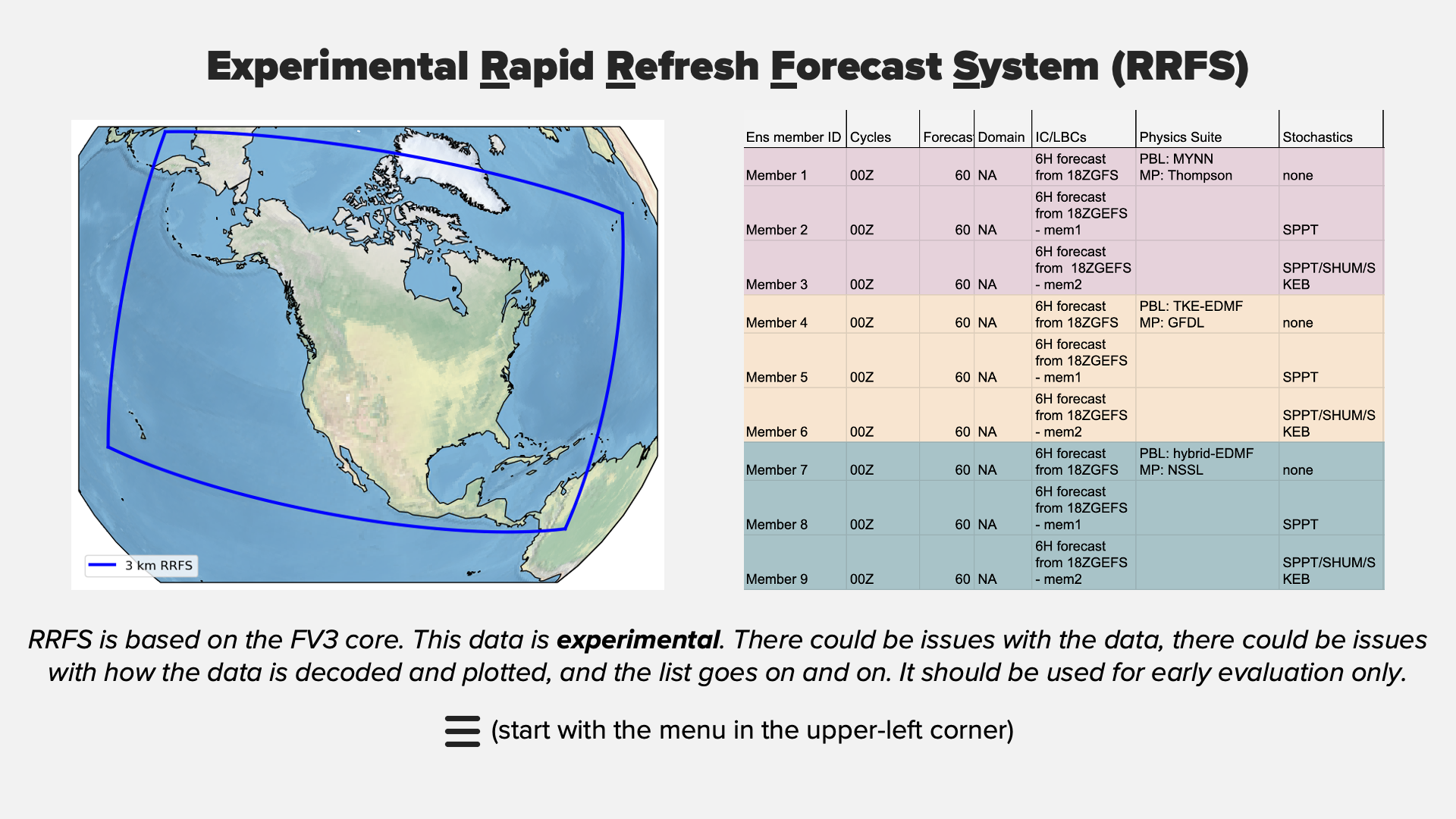
Experimental RRFS
2D Plan View Plots
Domain Selection
Western US
Utah
Desert Southwest
Pacific Northwest
Northern Rockies/High Plains
Surface
Mean MSLP & Wind Speed
Prob Wind ≥ 30kt
Thunder
CAPE/CIN
Prob Updraft Helicity ≥ 25
Radar
Composite Reflectivity
Max Reflectivity
Precipitation
1hr LPMM
3hr LPMM
Run Total LPMM
Run Total Blend
EAS PoP
EAS 1in/6hr
1hr FFG
3hr FFG
ARI 6hr
ARI 24hr
Meteogram Plots
Point Selection
SLC
KSLC
KHIF
KCDC
ATH20
KLGU
KHCR
KSGU
ZIOU1
KKNB
KCNY
CHPU1
BYCU1
KPUC
VEF
KLAS
KIFP
KEED
KIGM
KTNP
KDAG
KBIH
DEVC1
QMBA3
KDRA
CMP05
Other/Test
KPHX
KFLG
QSGA3
KSEA
GBLC2
KOMA
KSTL
CRKI1
Variable Selection
Wind Gust
CAPE
2m Dewpoint
2m RH
2m Temperature
Accumulated Precipitation